Identification of Landslide-Prone Areas Using Drones and Geoelectricity in Gang Sakal, Panjang District, Bandar Lampung
DOI:
https://doi.org/10.47355/jaset.v3i1.51Keywords:
drone; geoelectric; and landslideAbstract
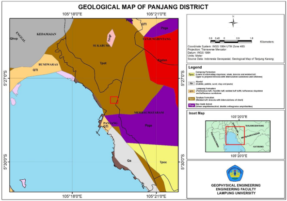
Bandar Lampung City is a densely populated area with a morphology influenced by steep hilly paths. High rainfall can produce hydrometeorological hazards in the form of avalanches. This study aims to examine the material vulnerability of landslides. A combination of topographic mapping using drones and subsurface imaging through ERT geoelectric. Two subsurface profiles were analyzed through the Wenner-Schlumberger configuration with a line length of 120 m and electrode spacing of 5 m. The morphological slope of the drone data processing results is 60 degrees. The dominant subsurface profile has a resistivity of 1 Ωm to >279 Ωm with a depth of 23 m in the first line and a resistivity of 1 Ωm to >343 Ωm with a depth of 23 m in the second line as pyroclastic material. The composition of constituent materials that have not undergone compaction and slope has the possibility of a landslide hazard in the two observed profiles.
References
S.A. Mangga, Amirudin, T., Suwarti, S., Gafoer., and Sidarto, S. Peta Lembar Tanjung Karang, Sumatera. Pusat Penelitian dan Pengembangan Geologi: Bandung, 1993.
Mulyasari, R., Darmawan, I. G. B., Effendi, D. S., Saputro, S. P., Hesti, Hidayatika, A., and Haerudin, N. Aplikasi Metode Geolistrik Resistivitas Untuk Analisis Bidang Gelincir Dan Studi Karakteristik Longsoran Di Jalan Raya Suban Bandar Lampung. Jurnal Geofisika Eksplorasi, 2020, 6(1), 66-76.
Mulyasari, R., Darmawan, I. G. B., and Haerudin, N. Perbandingan konfigurasi elektroda metode geolistrik resistivitas untuk identifikasi litologi dan bidang gelincir di Kelurahan Pidada Bandar Lampung. Journal Online of Physics, 2021, 6(2), 16-23.
Badan Nasional Penanggulangan Bencana. Indeks Rawan Bencana Indonesia. BNPB: Jakarta, 2011.
Karnawati, D. Gerakan Massa Tanah di Indonesia dan Upaya Penanggulangannya. Jurusan Teknik Geologi Fakultas Teknik Universitas Gadjah Mada: Yogyakarta, 2005.
Misbahuddin, A. Husna, R. Toriq, and A. Marwanto. Landslide Susceptibility Analysis Using Analitic Hierarchy Process in Sukatani and Its Surrounding, Purwakarta Regency, West Java. Jurnal Lingkungan dan Bencana Geologi, 2017, vol. 8, no. 1, pp. 19–30.
T. S. Dewi, S. B. Kusumayudha, and H. S. Purwanto. Zonasi Rawan Bencana Tanah Longsor dengan Metode Analisis GIS: Studi Kasus Daerah Semono dan Sekitarnya, Kecamatan Bagelen, Kabupaten Purworejo, Jawa Tengah. Jurnal Mineral, Energi dan Lingkungan, 2017, vol. 1, no. 1, pp. 50–59, doi: 10.31315/jmel.v1i1.1773.
R. Hidayat and A. M. Zahro. Identifikasi Curah Hujan Pemicu Longsor di Daerah Aliran Sungai (DAS) Serayu Hulu, Banjarnegara. in Prosiding Seminar Nasional Geografi UMS IX, 2018, pp. 41–50.
V. G. M. Pangemanan, A. E. Turangan, and O. B. A. Sompie. Analisis Kestabilan Lereng dengan Metode Fellenius (Studi Kasus: Kawasan Citraland). Jurnal Sipil Statik, 2014, vol. 2, no. 1, pp. 37–46.
Mulyasari, R., Suharno, S., Haerudin, N., Hesti, Hidayatika, A., Yogi, I. B. S., and Saputro, S. P. Aplikasi Metode Geolistrik dan Analisis X-Ray Diffraction (XRD) untuk Investigasi Longsor di Pidada, Kecamatan Panjang, Bandar Lampung. Eksplorium: Buletin Pusat Teknologi Bahan Galian Nuklir, 2021, 42(2), 131-140.
Muntohar, A. S., and Nugraha, R. A. Pengaruh Pembesaran Kepala Kolom Bentuk T-Shape Pada Sistem Fondasi Jalan Raya Terhadap Deformasi Akibat Pengembangan Tanah Ekspansif. Seminar Nasional XI, 2015.
Nandi. Longsor. Bandung: Jurusan Pendidikan Geografi FPIPS UPI. Ottosen, T.B., Petch, G., Hanson, M., dan Skjoth, C. A. 2020. Tree cover mapping based on Sentinel-2 images demonstrate high thematic accuracy in Europe. International Journal of Applied Earth Observation and Geoinformation, 2007, 84, 1‒12.
Thornbury, W. D. 1969. Principles of Geomorphology. John Wiley and Sons Inc.New York, U.S.A., 1969.
Pusat Vulkanologi dan Mitigasi Bencana Geologi (PVMBG), Wilayah Potensi Gerakan Tanah di Provinsi Lampung. Bandung, 2019.
Sugito, Irayani, Z. and Jati, I.P. Investigasi bidang gelincir tanah longsor menggunakan metode geolistrik tahanan jenis di Desa Kebarongan Kec. Kemranjen Kab. Banyumas. Berkala Fisika, 2010, 13 (2): 49-54
Reynolds, J. M. An Introduction to Applied and Environmental Geophysics, John Wiley & Sons Ltd. Chichester, UK, 1997.
Telford, W M, et al. Applied Geophysics Second Edition. Cambridge University Press: New York, 1990.
Sakka. Metoda Geolistrik Tahanan Jenis. Fakultas Matematika dan Ilmu Pengetahuan Alam –UNHAS: Makasar, 2002.
Loke, M. H. Tutorial 2D and 3D Electrical Imaging Surveys. Birmingham University: England, 2004.
R. A. van Zuidam and F. I. van Zuidam-Cancelado, Terrain Analysis and Classification Using Aerial Photographs: A Geomorphological Approach. International Institute for Aerial Survey and Earth Sciences, 1979. [Online]. Available: https://books.google.co.id/books?id=krziHAAACAAJ